Tag Archives: hike

Mount Manaia – A Stairway to Heaven

We pull off the Town Basin Marina dock with our friends on Q2 (Lewis, Sara and baby Skye) following us to a new anchorage, Urquharts Bay.  A beautiful, wide bay with lots of moorings and local boats.  This anchorage gave us access to many hikes and is located at the mouth of the Whangarei river. Despite how busy it was we secured a place all by ourselves.

Mount Manaia

Mount Manaia, Mt. Lion, Bream Head, and the Hen and Chickens, are scattered remnants of andesite, volcanic intusions that erupted 16-22 million years ago.  They are part of a 50km 2 (19 sq mi) stratovolcano that extended to the Hen and Chickens.

This is a sacred place for the Maori.  In former times, Maori placed the remains of their important chiefs on the tops of these rocks.  It is believed that the craggy peaks represent an important chief’s family who were turned to stone in a dispute over the infidelity of his wife.

The left arrow shows how high I went and the right arrow shows how high Matt, Rich and Michelle got (they rock climbed the last 20′).

Mt. Manaia is blanketed by native bush and has jagged peaks that jet up into the sky.  The entire area is a protected reserve which has a very well maintained track to the summit.

A Little Bit of Crazy

Our friends on Pogeyan (Rich and Michelle) invited us to go on this crazy steep hike up Mount Manaia.  We dragged Q2 along with us (even 3 month old baby Skye came along).  Matt and I had not been hiking in almost a year and I was a wee bit nervous to say the least.   Rich said it was a short hike (a little over an hour to the top), but it is straight up – a total vertical incline with over 800 steps peppered in to help you get up the super steep parts.  Yikes!

As we begin our journey our little pack slowly starts to split up.  Matt takes off, in flip flops no less, and leads the way, the other two guys are behind him for most of the trail.  Us ladies take it at a “more leisurely pace” and rest periodically as I am totally out of shape!

They installed really nice stairs over the super steep parts of the trail.  Every 100 steps there is a small mark, but I don’t believe it so I count myself.  I was spot on up to 600 steps but then things got wonky and I ended up wit 1226 stairs to the summit whereas the markers had 1136 steps.  Hmmm.  I had 2 other witnesses so I am going with my number of 1226 – which is a lot of stairs!

The Summit

After an hour we reach the platform and hope to find Matt.  And wouldn’t you know he found a crevice to hang out in….can you see him in the far left photo or the top right photo?

Michelle and I at the platform summit – I’m so happy to be sitting down.

The unbelievable views….

I’m guessing these are the children in the fable….

The Pinnacle on the Summit

We continue on around the corner from the platform summit.  Rich says we are not at the top yet.  So, we carry on and do a few rock scrambles.  At this point my legs are burning.  I made it to the 2nd highest point but couldn’t carry on so Matt, Michelle, and Rich did the last 20′.

The views were spectacular.  I wish I had the power to go up the last section but I had to save my reserves for the climb down.

We saw lots of beautiful Kauri trees and this beautiful stone archway.

At the end of the day we hiked up 1226 stairs or 104 floors, 4.1 miles and 9,759 steps.  The numbers don’t seem so impressive when you break it down. But it was a hard earned workout!

Our blog posts run 10-12 weeks behind actual live events.  This blog post occurred in late January.  Did you read about our new set of wheels in our last blog post?

Mana Island: a Refuge

After a crazy, fun filled week of activities, games, racing, and partying during the Musket Cove Regatta we seek out a refuge.  There is a weather system coming so we decide to head to Mana Island in the Mamanuca’s. But, first we stop at the outer reef in search of some crystal clear turqoise waters.

This was such a pretty spot, no other boats and gorgeous waters.  However, the winds started shifting making it pretty uncomfortable and rolly, so after one night we were off to Mana Island

We had really, really light winds for this very short downwind run.  We decided to put up the parasail because we were in no big hurry.  It was lovely, the sun was out, the breeze was cool, and the sail was gentle until we lost all of the wind.

It sure was nice while it lasted.  We arrived mid-day and took the afternoon off relaxing.  The next morning we had a beautiful sunrise.

Mana Island

We stopped at this lovely little island a few times last season (read 2022 blog on Mana Island).   We found a little spot in between a few reefs to anchor.  We let out enough scope to avoid the reef and were not expecting any neighbors.  To our surprise one small monohull anchored near us, but then left the next day because the winds pushed them too close to us.  Then another catamaran anchored between us and the reef and we had to tell them, politely, to move.

We had strong winds at 33kts out of the North, but Sugar Shack weathered the storm.

Hike Around Mana Island. 

There is a really lovely beach right in front of us, just beyond the reef.  It almost disappears at high tide, but during mid and low tide you can enjoy long walks.  Our beautiful walk starts on the beach and then wraps around over some coral/rocks to another beach.

This beautiful bird was catching some lunch and pretending not to see us.

Then it is straight up the hill where we pass the heli pad for Tadrai Island resort and the resort itself.

There are some really gorgeous views.  Can you find Sugar Shack in the top photo?

A view from another hill/mountain.  One looking East over Sugar Shak and one looking West over the village and the famous Mana Island Resort.

We then walk the ridge line down to the village and back to the beach.  I love the colorful houses in the village.  It is still low tide (see lower left photo).  We stop at a backpackers resort to have a drink and witnessed Superman carrying 4 dive tanks!  What a site.  It is a lovely hike. 

Cicumnavigating Mana Island

The next day we actually walk aroudn the entire island, 4.6miles.  We did not realize we could walk in front of the Tadrai Island Resort so we were always cutting up the hill.  But this time, we walked the entire island.

We find a magnificent blow hole and a a little private pool that Matt decides to enjoy.

Not sure if you remember, but the TV series “Survivor” is shot on Mana Island (we mention it in our 2022 post).  When we do the complete around the island hike we find several Survivor sets (big open fields for challengs), the control room (where the director works), and the elimination stage.

Below is one of their cleared fields where they hold challenges.  We are not sure if these rafts are part of Survivor or just local island rafts.  But they were super cool and constructed of natural products: bamboo and vines.

A special preview just for you our trusty readers….the Honeymoon Survivor Australia was preparing to start filming as we were here.  We got a few snapshots of the sets before they even make it on film!

The top left is a special honeymoon suite, bottom left is their shower with lots of fresh water, bottom right is their very special toilet and top right is a pre-made raft.

So many walks and so many views…

And a good, hard walk wouldn’t be worth it without a reward…we have tasty drinks at the Mana Resort.

Super good hike requiring us to walk on beaches and over rocks, with a total trip of 4.7 miles.

Sandbank Day

There is a spit of land aptly called “The Sandbank” where day charter boats go for an afternoon picnic.  We have passed by it a number of times and this day we decide to take the dinghy over.  We packed some snacks and cold drinks and hit the road.

This sandbank disappears at high tide so you can only visit mid-to-low tide.  

Nothing but turquoise waters, a little sand, and some broken coral.  But truly beautiful to sit in the shallow water with a cold drink enjoying the peace.

I could get used to this little spot!  We snorkeled the reef and found some beautiful schools of fish and lots of hard coral.  Not much soft coral but that is to be expected.

We end up spending 2 weeks at Mana.  We walked around the island several times, enjoyed cocktails at both resorts and hung out with some friends.

Our blog posts run 10-12 weeks behind live events.  This blog occured in mid-September.  Don’t miss out on the Musket Cove Regatta Festivities posted in our last blog.

The Majestic Cliffs of Kenutu

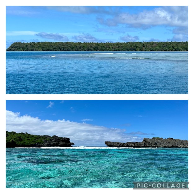
Our last anchorage in Tonga was a spectacular one!  We picked this remote easterly island based on its location for the upcoming winds.  Plus, we wanted to hit one island on all four sides of Vava’u.  The winning island was Kenutu.  This is a long, pretty flat island with several white, sandy beaches and a thick forest inland.

It can be a bit of a challenge navigating to Kenutu because of all of the reefs.  We had to ensure we had good visibility and updated satellite charts to make it safely, which we did!

Kenutu, Tonga

Kenutu, Tonga

We arrived around 1500 which did not leave us much time to explore before dark descended upon us.  So, we jumped in Sweetie and worked our way through the reefs near shore.  A friend of ours told us that there is a 10-minute walk to the other side so we decided to investigate.

Exploring Kenutu

The path was easy to find as someone put a float in the tree with “trail” hand written on it.  Easy enough.  The first trail we found was truly a 10-minute walk to the other side.  But what we saw shocked us!  The colors were so vibrant!

The rocky cliffs shouted out with bright reds, browns, and greens while the water below had dozens of variation of blues and greens.  I loved watching the waves come up over the table creating a shallow pool.

Another beautiful hillside with more colors.  We found several trails on the east side of Kenutu.  We walked on all of them that we could find.  Each bay was just as beautiful as the last.  One of our walks led us down to sea level where we could witness the blow holes and surf up close and personal (lower photo).

One bay had several blow holes that showed off in a spectacular fashion.  I could have sat here and watched this fierce display of water all day!

It was getting dark and we wanted to explore by dinghy.  We went around the southeast side of the island and found a lovely pass.  But it was too rough and too shallow for us to go through by dinghy.

If we had more time we would have certainly stayed at this Kenutu anchorage longer.  What a beautiful surprise it was to see this island.

The next day we had to pull up the hook and go back to Neiafu to clear out of Tonga.  Super sad as we really did not do the Kingdom justice in 3 weeks.  I would love to come back here and really explore all three archipelagos.

This blog occured in mid-August 2023.  Our blog posts run 8-10 weeks behind actual live events.  In our last blog I share details of Vava’u.